Launch of Chicago Health Atlas 3.0

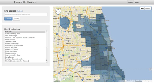
Last week we launched our third major update to our Chicago Health Atlas project.  This is the most robust version of the Atlas released since its debut in 2012. The Atlas is funded and receives significant thought leadership from the Otho S. A. Sprague Memorial Institute. Sprague, and their Executive Director Jim Alexander, has shepherded this program for years.

Chicago Health Atlas, along with all of our other health products like Foodborne Chicago and Smart Health Centers, is managed by Smart Chicago Director of Operations Kyla Williams with lots of help from Program Coordinator Sonja Marziano.

Chicago Health Atlas 1.0

Chicago Health Atlas 1.0

The first version of the Atlas was a simple lookup tool for existing data. DataMade, a local firm that builds custom visualizations, deploys civic apps, and trains people to work with open data, has been an essential tech partner all the way through to this version. The site is based on the Derek Eder’s wildly influential and immensely useful Searchable Map Template. Derek was also important in helping me move from the Weave (Web-based Analysis and Visualization Environment) platform and set up a structure that met Smart Chicago’s vision for the site.

Last year we conducted a CUTgroup test on the Atlas and found that users were a little confused with the original navigation.

Continue reading

Developer Resource: Twilio

We love text.

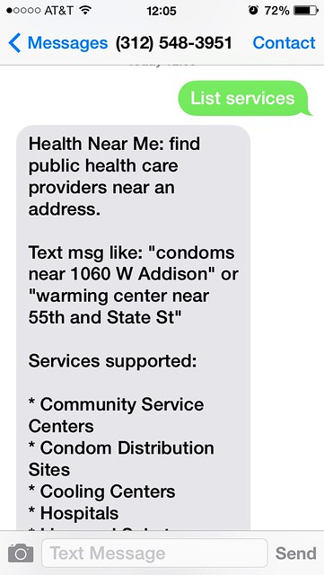
And as big fans of texting, Smart Chicago has had Twilio as part of our offerings for civic developers since the say we started the program.  We’ve recently expanded our partnership with Twilio, and their local developer relations guru, Greg Bagues, to offer Twilio as a separate service through Smart Chicago. Twilio is a great product that makes it easy to create apps that can make and receive both calls and texts.


Healthnear.me

We use it in our own products:

We are also a customer of Textizen, which uses Twilio, including around the Creative Chicago Expo. Civic software developers like Chris Gansen use it to power apps like HealthNearMe.

Like we said, we’re big fans of texting. If you’re new to Twilio, we’ve put together a how-to post of how the app works.

If you’re a civic developer and are interested in using Twilio for your app, please fill out the form below.

On the launch of Crime and Punishment in Chicago

Smart Chicago Collaborative is proud to launch our latest Civic Works Project: Crime and Punishment in Chicago. This project is a collaborative effort among Smart Chicago, FreeGeekChicago, and the Chicago Justice Project.

Chicago Police Department Memorial at Buckingham Fountain

Photo by Chris Smith / Flikr

The Crime and Punishment in Chicago project provides an index of data sources regarding the criminal justice system in Chicago. We aggregate sources of data, how this data is generated, how to get it, and what data is unavailable. This project is a key way we are using the Civic Works grant to use data journalism to uncover the value of data and cover the stories behind the data.

Continue reading

Get A Flu Shot in Chicago

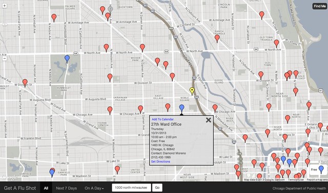
Once again, super-citizen Tom Kompare has come up with a timely, teeny piece of software that helps Chicago residents do important things. Last week, Tom launched www.chicagoflushots.org, a way to find and plan your flu shot this season in Chicago.

Get A Flu Shot in Chicago

Here’s Tom’s explanation of the site:

Built by Tom Kompare in partnership with the Chicago Department of Public Health (CDPH). This was not developed by CDPH and CDPH makes no representations as to the accuracy of the information provided by this map application. This map application is hosted by the Smart Chicago CollaborativeThe code behind this web application is free, open, and under a MIT License. Feel free to send me comments.

Here’s complete information from the City of Chicago, including the current situation in Chicago, why you should get vaccinated, recommendations for treatment if you get the flu, recent news, and other supporting information.

Here’s a snip from an email from CDPH kicking off their flu shot program:

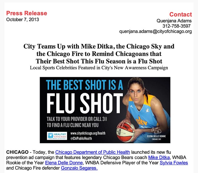
Last month, CDPH announced over 60 special flu vaccination clinics the department is hosting in communities across Chicago through December 14. CDPH also launched an updated version of its online Flu Clinic Finder that pinpoints CDPH clinics by zip code.

Chicago Department of Public Health Flu Shot Campaign 2013


Here’s coverage from ABC 7 News: Health officials: Get your flu shot now.

Smart Chicago is all about providing connective tissue (so to speak) among residents, developers, and government to make lives better in Chicago. Plan your flu shot today.

CUTGroup #2: Go2School

It’s August in Chicago, and the attention of parents and kids turn back to school. There are lots of changes this year in the Chicago Public School system, with school closings & consolidations and safe passage routes  dominating the news and affecting thousands of families.

At Smart Chicago, we don’t play any part in these matters. But since a large part of our mission is to use technology to make lives better in Chicago, we’ve tried to play a small part in making this transition easier. We host and support an app created by local  developer Tom Kompare called  Go2School, a website that allows you to explore travel options to your Chicago Public School. He came up for the idea for this site while when trying to figure out the best way to get his daughter to school – either by public transportation, car, or walking.

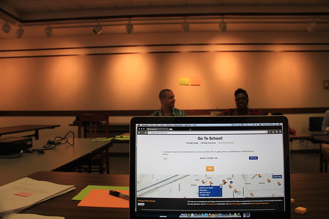
CUTGroup #2/ Go2School, Tester #5

We’ve worked with Tom since the Spring to get server space for his creation, and in late May we tested his app with select members of the CUTGroup, a set of regular Chicago residents who get paid to test civic apps. Following is the results of those test.

Segmenting

In Mid-May we sent two emails to all members of the CUTGroup in order to find the most relevant people with whom to review the site. This complete list of CUTGroup members was 368 people, spread across the city. We segmented on two things:

  • Must be responsible for taking one or more child(ren) to a Chicago public school this fall
  • Must be available for testing on either May 28 or May 30

There were 28 people who responded to these requirements. Based on the locations of these people,  we decided to hold tests at two libraries: the Kelly Library in the Englewood neighborhood on Tuesday, May 28th at and at the Uptown Library in the Chicago Uptown neighborhood on Thursday, May 30th. There were 14 people who expressed interested in each location.

Personas

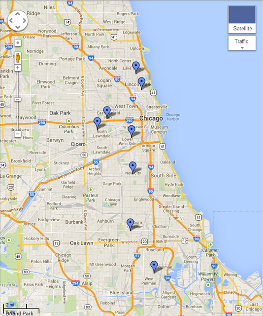
We conducted eight tests with people. We discovered at test time that one of the participants did not have a child in a Chicago Public School (his daughter did, but she couldn’t make it to the test, so he attended for her. We ended up having a great conversation with him, but his results are not included here). Here’s a look at the general neighborhood locations of the testers, showing wide geographic distribution:

Distribution of Testers for CUTGroup002 / Go2School

The testers were spot-on knowledgable about the topic of getting kids to school on time. In an effort to maintain privacy and to provide the widest possible utility of our testing to civic developers everywhere, we developed some shorthand “personas” that helps in identifying their stance vis a vis the app. We took some video/ screencasts of the tests. Here are some helpful cuts of the feedback. If you click to view the files on Vimeo, you can jump directly to the area of interest.

CUTGroup #2, Tester #2 Father responsible for three children (17, 16, and 10) Samsung Galaxy Kelly Library, Englewood

CUTGroup #2, Tester #2 Father responsible for three children (17, 16, and 10) Samsung Galaxy Kelly Library, Englewood from Daniel X. O’Neil on Vimeo.

0:04: Trouble with Next Button: After a valid address was entered. Would not accept a click, then it did.
0:54: Second Search: Executed with no problems
1:40: Mindful of danger: Schools and families talked about preferred routes
2:31: Jazzing it up: Would be helpful

CUTGroup #2, Tester #3 Public wifi searcher with one child and sometimes one additional child at another location

CUTGroup #2, Tester #3 Public wifi searcher with one child and sometimes one additional child at another location from Daniel X. O’Neil on Vimeo.

0:04: No broadband at home: Heavy user of public wi-fi
1:10: Homepage map confusing: Because it has nothing to do with where she lives.
1:47: Thought there would be more information about the school: Very much likes having custom school info on the site.
2:38: Her usual route is simple. But sometimes she takes a friend’s child to a different school via a more complex route
3:44: Tries that route: Notwithstanding my instinct to do it for her.
4:00: Starting over was a bit of a challenge: Back button shenanigans and back-space/ deleting the entire length of the pre-populated school name.
4:46: The other school she’s interested in is not a CPS school: “So this is useless to my now”
5:30: But she tries a workaround: With the “Explore Map” link.
6:19: Then she found a bug: Noble Street Charter School was geocoded incorrectly in the original data.
6:41: Back to the workaround: In finding a route to a Catholic school.
7:17: Issue with the time picker: She wants to enter the time she should leave in order to get there on time, rather than entering the time she needs to arrive (which is how the system is designed).
7:40: Then somehow the back button was invoked. Don’t really know how. She recovers and again enters the time she thinks she should leave to be there by 8AM.
8:12: Did not know she had to pick a day. And did not readily see the error condition. Also: still wants to enter *departure* time rather than arrival.
9:58: And now the error re: arrival time becomes evident. And that was a bummer.
10:48: This was an excellent user test. Very grateful.

CUTGroup #2, Tester #5 Clock-watching, train-watching mother of three Samsung Galaxy Note II Uptown Library

CUTGroup #2, Tester #5 Clock-watching, train-watching mother of three Samsung Galaxy Note II Uptown Library from Daniel X. O’Neil on Vimeo.

0:04: Error Correction: Chose the wrong school from list; used delete button to erase entire school name and go back to the pre-populated list, where her child’s school popped up again
0:33: Pressing the delete button: Many times, quickly, so as to go back to the pre-populated form with school names
1:06: Missed the “what day” choice: User did not select what day they were traveling and could not move forward in the interface upon clicking “Next” . She chooses “time to arrive” just fine…
1:19: But then clicks “next” repeatedly: Not seeing that there is an error condition (did not choose a day for travel)
2:30: User does not want to see route on map: Because she is so familiar with it. She wanted validation of her routes and clarity on exactly what time she’d get there, and that’s that. She’s happy.
3:12: “It will really help all the parents know what time they should leave the house” — What this website does

Upshots

Beyond this super-specific feedback, there were a number of themes worth calling out:

  • People seemed to want to have more school-specific information. For instance, they loved the “call school” option featured on the main directions page. People seemed to expect to get custom info about the school they choose in the lookup tool, and were delighted when it was delivered. Many people called this out as a key differentiator from Google Maps or the like
  • Almost everyone called out the three options— walking, CTA/Metra, or driving— as a positive thing
  • Lots of people had trouble with the “when do you want to arrive” time / date picker screen. We have some good views of this in Tester #2 at 1:06 and Tester #3 at 7:17, 8:12, and 9:58
  • At least two of the parents independently called out safety as a consideration in route planning
  • People seem to really like and use the Chicago Public Schools “Parent Portal” and mentioned it often as a main resource for information

Perhaps the most common of the site’s compliments was the ability to choose which date to leave and which time

All Test Data

Here’s the raw spreadsheet with all of our notes from each of the tests we conducted:

Join us!

Are you interested in joining 500 of your fellow Chicagoans in the CUTGroup? Do it!

Chicago Developers: US Department of Labor Launches Smartphone App Contest Around Fair Labor

My colleague Matt Bruce pointed me to this new app contest: US Department of Labor launches smartphone app contest. Here’s a snip:

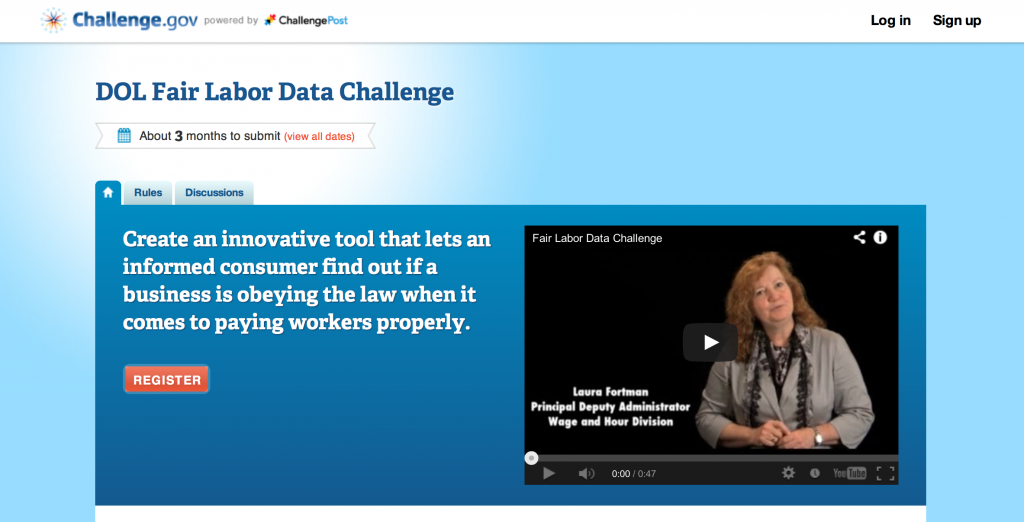
The DOL Fair Labor Data Challenge, which can be accessed at http://fairlabor.challenge.gov, calls for creating a smartphone app that integrates the department’s publicly available enforcement data with consumer ratings websites, geo-positioning Web tools, and other relevant data sets, such as those available from state health boards.  The winning app is expected to be creative, innovative, easy to use, and will incorporate data from http://ogesdw.dol.gov/index.

“The app we would like to see developed would work with existing social media and would allow consumers to see if an establishment that they want to frequent has been in compliance with federal labor laws,” said Laura Fortman, principal deputy administrator of the Wage and Hour Division. “The app could also prove a useful tool for job seekers and for companies that are deciding which firms they may want to do business with.  It could also help individuals get in touch with the Labor Department if they have any questions.  As we mark 75 years of the job protections afforded by the FLSA, we are looking forward to using new technologies to encourage compliance with the law in the 21st century.”

DOL Fair Labor Data Challenge

Matt runs the just-launched Chicagoland Workforce Funder Alliance (CWFA) that is housed here at the Chicago Community Trust, just like Smart Chicago. One of the issues he’s working on is the deterioration of labor standards in low-wage work.

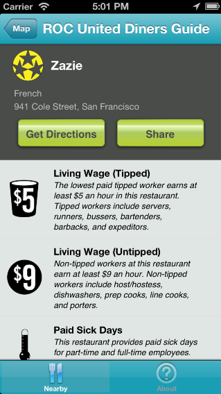
roc-national-diners-guideA national group called Restaurant Opportunities Centers United (ROCUnited) has the ROC National Diners Guide, which is an app that shows national data around labor practices around national food chains. It would be great if we could see all local restaurants, allow patrons and employees to report issues, and include local labor data in an app that takes this concept further. There is great leadership here at Restaurant Opportunities Center of Chicago (ROC-Chicago) as well.

I’d be happy to look into the types of data available at state, county, and city sources that could be used in such a system  I think this would be a great use of civic technology energy and I hope to find some co-collaborators on this, If you have any ideas or are working on similar issues, hit me up at doneil@cct.org.

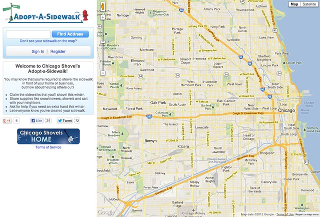
Adopt-A-Sidewalk is Re-Launched Along With Mayor Emanuel’s Chicago Shovels Program (Just in Time!)

Mayor Emanuel Announces Chicago Shovels for 2012

The Smart Chicago Collaborative is proud be a part of Chicago Shovels, Mayor Rahm Emanuel’s initiative to help connect the public with City winter resources and empower neighbors to come together to help Chicago navigate winter. We worked with the City of Chicago and the Chicago Code for America Brigade to re-launch of Adopt-A-Sidewalk.

As part of the Race for Reuse Campaign at Code for America, local civic hackers helped to move the City of Chicago’s Adopt-A-Sidewalk app onto servers hosted by the Smart Chicago Collaborative, document the code, and publish it as a fresh instance to Github. This means that developers can continue to improve the site by adding new features and continuing to integrate additional data sets as the city expands on its data offerings.

The Race for Reuse is a nationwide effort to help redeploy civic apps all across the country with 28 cities helping to deploy 31 civic apps. Adopt-A-Sidewalk was originally built as the Boston-focused Adopt-a-Hydrant app that lets citizens adopt hydrants that they agree to take care of in the event of snow.

Chicago has modified this code and added map files of every sidewalk in the city. Residents can claim sidewalks during snow events (like tonight!)– pledging to shovel their own walks or take care of a neighbor’s 25 feet of love. If you can’t shovel your walk and need help, The app will also let people indicate that they need help with their sidewalk. Volunteers can then go into the app and adopt that particular sidewalk.

This Vista Never Fails Me: Lincoln Park Zoo Nature Boardwalk in First Snowfall, December 2010

Lots of people worked on this app. Chief among them is Ryan Briones. He is an IT Director for Software Architecture and Design at the City’s Department of Innovation and Technology, but he worked to configure the server and document the code on his evenings, civic hacker-style. He is longtime member of OpenGovChicago and just flat-out cares about this stuff.

Christopher Whittaker, the Code for America Brigade Captain here in Chicago, shepherded the entire process and did a goodly amount of tweaking as well. He is a tireless organizer and he’s been a a continued link to the key national Code for America organization, from which all of this sprung.

When Adopt A Sidewalk launched last February, it was set up mainly by a group of dedicated team centered around the Obama for America tech team. This included Scott VanDenPlas,  Aaron Salmon, Arun Sivashankaran, Ben Hagen, Chris Gansen, Jason Kunesh, Jesse Kriss, Nick Leeper, Ryan Kolak, Paul Smith, and Scott Robbin.

This time around, Michael Barrientos and Emily Rosengren worked to get us to launch. Derek Eder gave some advice, Rebecca Ackerman enabled zoom, and Joe Olson of Tracklytics helped with DNS configuration.

Chicago is no stranger to community technology for the wintry mix. In 2011, a great group of people emanating from the Chicago Tribune news apps team that created and worked the ChicagoSnow Crowdmap (Ask for help, lend a hand: Blizzard 2011). We spent a couple nights managing and mapping 984 snow help reports for the blizzard of February 1, 2011. Here’s a super-detailed writeup. It was a great test case in community building around a weather event.

People interested in civic hacking are encouraged to meet to talk policy, data, and technology at the OpenGovChicago meetup group. You can also head over to the Open Gov Hack Nights at 1871 located inside the Merchandise Mart. These growing gatherings, hosted and supported in part by Smart Chicago, are a great way to get a mitt and get in the game on civic hacking.

Here’s a video explaining the program:

Help Improve Adopt-A-Sidewalk

In February of 2011, a massive blizzard hit the City of Chicago effectively shutting the city down for a day and a half. Lake Shore Drive, Metra lines, and business closed down as the city was buried under 20 inches of snow.

In the storm’s aftermath, Chicago cleaned itself up with neighbors helping neighbors shovel out the snow. In that same spirit of being good neighbors, Chicago is joining Race for Reuse to push adoption of the Adopt-A-Sidewalk app.

Adopt-A-Sidewalk is Chicago’s implementation of the Adopt-A-Hydrant application. Users adopt a sidewalk that they agree to shovel after a snow event. Through the site, you can also share resources like snow blowers and salt as well as let people know that your sidewalk has been cleared. More importantly, those that need help clearing their sidewalk can do so through the app. This will let volunteers, who sign up through the city’s Snow Corps app, know which sidewalks also need to be cleared.

Through a partnership between the City of Chicago and Code for America and the Smart Chicago Collaborative, the Adopt-A-Sidewalk app is getting overhauled for the new winter season. The app has been open sourced on GitHub and civic hackers are invited to help improve the app. The app will be hosted on the Smart Chicago Collaborative AWS account in order to make it easier to implement improvements to the Adopt-A-Sidewalk code.

Christopher Whittaker (cwhitaker@codeforamerica.org), the Code for America Brigade leader here in Chicago, is leading this effort. Civic hackers interested in working on Adopt-A-Sidewalk are invited to come to the OpenGov Hacknights Tuesdays at 6:00pm inside 1871. There we’ll discuss needed improvements and enhancements to the app.

Adopt a Sidewalk

Center for Neighborhood Technology Urban Sustainability Hackathon

CNT Reinventing Chicago Hackathon Judging Rubrick

Recently I helped out in judging for the Urban Sustainability Hakathon hosted by the Center for Neighborhood Technology (CNT). The event focused on a subset of the data available from the City of Chicago data portal under sustainable development, energy, transportation, water, buildings, parks/ open space/ food access, and climate.

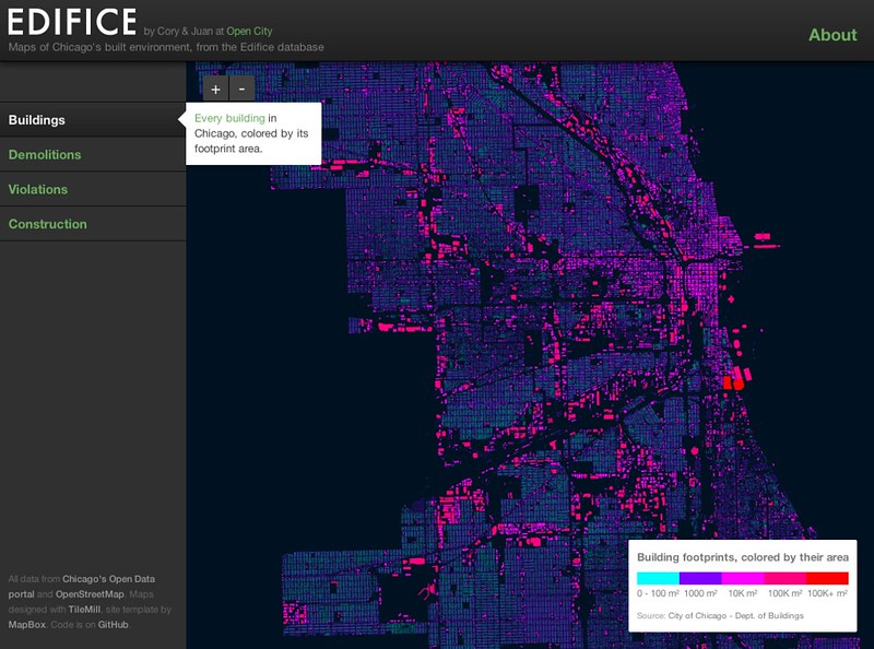
It was a really great event. I haven’t been at a hackthon since the Knight-Mozilla-MIT “Story and Algorithm” Hack Day back in June, and it has been even longer since I’ve been to a local hackathon. CNT wrote a comprehensive blog post about the event. They have details on all six entrants, including the winner (Edifice) and the two runner-ups (Jitney Driver and Hidden Value in Abandoned Property).

Here’s some thoughts:

Community matters

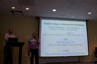
CNT Hackathon: Hidden Value in Abandoned Buildings

The great value of this event is the community that results from people meeting and working together. A great example is the Hidden Value in Abandoned Property team of Audrey Henderson and Dan Fehrenbach. Derek Eder made a great tool for viewing reports of vacant and abandoned buildings, but Audrey had a great idea for this data that goes beyond just seeing the data on a map by pairing it with other data that shows its value. She met a great CNT developer in Dan and they executed on a beta of the idea. That kind of connection is worth everything in this world.

Policy is implicit in apps

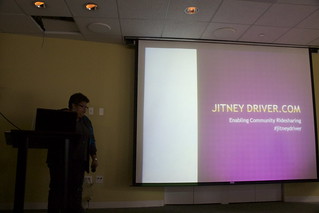
CNT Hackathon: Jitney Driver

I was impressed by the team and the thinking behind Jitney Driver. Paula Robinson led us through a presentation about the social and economic benefits of jitney drivers. She referenced August Wilson’s play Jitney, play is set in a worn-down gypsy cab station in Pittsburgh, Pennsylvania, in early autumn 1977. Since I actually lived in Pittsburgh in 1977, and well-remember the idea of jitney cabs.

She spoke of how shared rides lead to more connection among neighbors, how jitney driving could lead to local jobs and keeping money in the neighborhood, and how this type of service could fill an existing gap in transportation service. Some in the panel and audience talked about how this plays within the licensing requirements of the City, and even talked about whether we would be customers of such a service.

It was a refreshing example of people coming together to talk about how technology can affect a wide range of areas in society.

Civic Data is Big Business

The winner of the contest was Edifice, created by Cory Mollet and Juan-Pablo Velez. It is a great example of a product that pulls together a series of free things (four types of public data, Open Street Map, Tile Mill, and so on) in a way that creates a whole lot of value. It’s a good reminder that mining public data can lead to great businesses. I have high hopes for Edifice and the entire civic innovation industry here in Chicago.

Edifice Maps

Here’s a complete set of photos I took during the wrap-up of the hackathon. Congratulations to all participants– keep it up, and consider taking part in the Illinois Open Technology Challenge.

List of Apps For Metro Chicago Applicants

Last year the State of Illinois,  Cook County, and the City of Chicago announced its first-of-its-kind application development competition, “Apps 4 Metro Chicago Illinois (A4MC)”.  This was the first government-sponsored apps competition in Chicago, and the first anywhere that included collaboration among three different units of government. Here’s a press release about the competition from the City.

The A4MC competition was run by the Metro Chicago Information Center, which closed in March 2012. The A4MC website is no longer available on the Internet. Here’s a list of as many entries as we could cobble together, along with some basic info about the apps, listed in alphabetical order. We’re certain that we’re missing some things and we’d love to hear any updates about your apps or new projects. Please write me at doneil@cct.org with updates!

42nd Ward Crime answers the question: How safe is your block in the 42nd Ward. Select a block, give your email address and at no charge an alert will be sent to the user’s email automatically whenever an incident is reported.

AllSchedules gives you access to a huge collection of transit schedules, for different transport modes (bus, metro, train, tram ferry, etc.), in multiple cities around the world.

Bikes on Metra – “Can I bring my bike on Metra right now?” is an application that answers this question with a simple text display of “Yes, you can” or “No, you can’t” for each Inbound and Outbound Metra train.  This text display tells the user when a bike can or cannot be brought on board a Metra train, help the user find bike parking around Metra stations, and advise them on specific rules and tips for bringing bikes aboard.

Buster is a CTA bus and train tracker application that is designed for the subset of transit users that use the service every day as their main mode of transit.

Chicago and Friends is a social networking online magazine that connects the community through geolocation and Facebook.

Chicago City Crime is an Android application that provides a convenient and simple mechanism for users to quickly get crime information, based on their current location in Chicago. By becoming more aware of how many and what types of crimes have been committed around their area, this allows them to make informed decision and action that will benefit them and their community.

Chicago Crime Viewer  helps people find maps of crime in Chicago for a better understanding of neighborhood issues and trends. Quick access to this authoritative information supports real estate, commuting, and situational awareness decision making across the City of Chicago.

Chicago Lobbyists is an open data, open government, and open source project intended to improve the transparency of interactions between the City of Chicago and lobbyists and their clients.

Chicago Local Guide is an Android app meant to help local people as well as tourists find interesting places and points-of-interest near them; locate specials and promotions from local businesses; get updates on cultural, social, and technology events around Chicago; and hear breaking local news.

The Chicago Metro Information (CMI) Real Time Screensaver is an application designed to turn any unused computer screen into an electronic billboard displaying “up-to-the-second” data images for the Chicago Metropolitan Area, such as the forecast, street traffic, and public transportation schedules.

Chicago Recycle Helper is a web application that helps people locate recycling drop-off points for various materials in the Chicago area.

Chicago River Viewer is an interactive mapping web application designed as a one-stop resource, so that anyone interested in learning more about the Chicago Area Waterway System.

Chicago Rider is designed to get you the information you need quickly. See nearby stops, favorite stops, and real time bus schedules at a glance.

Chicago Service Request  is a web application that allows you to store additional information about a service request either as a picture, mapped location, and/or note.

Chicago TIF Viewer is a unique map viewer allowing free access to data and services with three features: Tax Increment Financing District Information, Ward Contact Information and US Census 2010 Unemployment Rates.

Chicago Wards I-Map is an interactive map of Chicago which provides ward information for every square foot of the city, which includes the ward number, alderman’s name, telephone number, and office locations.

ChicagoTXT is a text message feature that allows the user to get upcoming train and water taxi departure times to any phone.

ChiTxt provides residents a way to access city information without the need of an internet connection. Anyone who has a cellphone with standard text-messaging can use ChiTxt to get information about city services like health facilities, soup kitchens, and more.

Chicago Public Library (CPL) Mobile is designed to provide easy access to Chicago Public Libraries’ (CPL) resources everywhere for users on mobile devices and tablets.

Crime Alert is a cross-platform web application that serves to alert users of crime in their community and surrounding area as rapidly as possible, and receive information that is relevant to their lives.

FasPark helps drivers find street parking in real time.

FixIt! is a mobile app that allows Chicagoans to report issues, like public property damages, that require city attention. It automatically requests confirmation from participating citizens who are in the area and uses their responses to highlight critical reports while sifting out erroneous ones.

FOIAshare brings together FOIA request logs so viewers can share insight on the information that they have requested, view trends and search for records.

GoChicago grants users the ability to make a list of the places in Chicago they’d like to see, view directions to each place on a map, or call the place for more information.

Got Game?  is designed for residents to choose an activity, find parks near them that support the activity and schedule a game, enabling people to meet up and use the facilities at the parks near them.

Heads-Up Chicago pulls together up-to-date information of all the FREE Admission Days at local Chicago Museums and “Kids Eat Free” Days at local Chicago Restaurants, into a clearly outlined monthly calendar and daily planner format. This software will help parents to easily plan their family trips into the city, while helping Chicago organizations and institutions gain exposure while playing a part of creating memorable experiences for families within the Chicago Metro area.

IBikeChicago is an Android app built to support and enhances the biking community in Chicago. The application allows the users to locate bike routes, bike racks, and bike shops in the City of Chicago.

IFindit Chicago is an Android app that is designed to help low income and homeless Chicago residents connect with critical resources such as medical clinics, food pantries, shelters, etc in an easy to use, comprehensive and sharable format.

InThirty is an application used to see what Chicago city transportation resources that a user can access within a thirty-minute train, bus, or bike ride.

LIGHT BULB FINDER empowers consumers to make informed choices based on their own lighting needs and financial priorities. The app estimates the energy savings from changing the bulb and how long it will take for the new bulb to pay for itself. It also calculates a home’s total energy savings potential and environmental impact for recommended bulb replacements.

Green Habit (GHabit) is a social network with a simple goal to inspire people and organizations to create a greener and sustainable habitat. By inspiring green habits, each individual will take action to recycle, reuse and reduce waste, conserve resources, live a healthy lifestyle, demand eco-safe products, be innovative and implement new ideas, and energize the green movement.

MassUp.us  is “Chicago’s Social Cycling System” web application that serves communications and navigation information needs for social and personal bicycling. It broadcasts maps, news, weather and more, for smartphones and text messaging. MassUp.us is also used for details about local events (“masses”), to find riders, check conditions, record, share and chat.

Metro Chicago Farmers’ Markets is a tool helping residents find farmers’ markets, identifying and plots on the map, the nearest open farmers market to the current location.

Mi Parque is a bilingual participatory placemaking web and smartphone application that helps residents of the community contribute and share their vision for the future of Little Village’s new parks.

“Mom, We’re Bored” is an application for anyone with children aged 2-12 to help find activities kids will love, going on right now, nearby.

OkCopay is a comparison search engine for medical care that allows users to search for the procedure they need, compare local providers, and view their actual prices. OkCopay hopes to be a trusted resource all Chicagoans can use to find the medical care they need.

OwtSee is an Android based and a web based application that presents information about the Chicago parks and community events in one convenient place.

See How Mobile is an application that calculates how ‘mobile’ any Chicago address is. It determines the distance to the nearest El, Metra, bus, or highway, and then tells good (or bad) those distances are compared to every other location in the city.

Recycle City Chicago is an application that helps Chicago residents recycle by finding the closest recycling drop-off facility and driving direction to that location.

SpotHero is an application that efficiently connects parking demand and parking supply. We allow parking spot owners to earn income by renting their spot when it’s unoccupied.

Spothole is an ongoing project to create tools to enable Chicago residents to more conveniently participate in the process of maintaining their neighborhoods’ streets, starting with Logan Square.

SweepAround.US helps Chicagoans find out when residential street sweeping will next occur in their neighborhood, and allows them to sign up for email or text message reminders or subscribe to calendar feeds.

Taxi Share Chicago is an application designed to increase efficiency, reduce CO2 emissions and cut down on already congested streets and highways.  The app allows users to find each other and share a cab to popular destinations around the city and to the major airports.

Techno Finder  helps you find public WiFi near your location by using a cell phone or home phone, the web, or smart phone.

Thank you Officer is a web-based application initiative with the goal to mail a physical personal thank-you card to every police officer in Chicago, and let them know that we appreciate them.

TrailBlaze Chicago records and anonymously reports your bicycle tracks, allowing you to vote for new paths simply by carrying your phone while you bike.

Transit Stop: CTA Tracker is a quick and easy access to bus and train arrival time estimates for every Chicago Transit Authority bus and train stop.

Transitsocial -Transit Social is a unique and new place to search public transportation and socialize.

TreKing (Chicago) is an Android app that supports all four major transit systems in Chicago.

Vacant and Abandoned Building Finder is a tool for helping people and organizations find buildings in Chicago that are not in use and are potentially hazardous to the neighborhood.

WasMyCarTowed.com is a single-serving website that lets Chicagoans quickly answer the question, “Was my car towed?”

What’s Driving Costing You in Chicago? is a compact simple tool designed to educate divers about their driving costs. This tool provides map data including optional live traffic conditions and specific route information between start and end locations.

Here’s the announcement of winners:

FOR IMMEDIATE RELEASE
December 16, 2011

CONTACT:
Kathryn Auerbach – Metro Chicago Information Center
312-580-2597
kauerbach@mcic.org

APPS FOR METRO CHICAGO ILLINOIS WINNERS ANNOUNCED!
SpotHero wins Apps 4 Metro Chicago Grand Challenge, OkCopay is the Innovate Illinois Award winner and Recycle City Chicago and Chicago Recycle Helper with the Green Opportunities Award!

Mayor Emanuel’s Director of Social Media Kevin Hauswirth and Governor Quinn’s Chief Operating officer Andy Ross announced the winners of the Apps 4 Metro Chicago Illinois Grand Challenge and the Innovate Illinois Award today at Excelerate Labs. They were joined by the Delta Institute who announced the winner of the Green Opportunities App Award (GO Award). The Apps 4 Metro Chicago Illinois (A4MC) competition is facilitated by the Metro Chicago Information Center (MCIC), a nonprofit research, consulting and information resource committed to increasing the quality, quantity and accessibility of information, and guided by a fundamental philosophy that better information produces better decisions. The A4MC Competition is a collaborative open data civic applications competition which brought together software developers, nonprofits, and residents to create web and mobile applications over 300 data sets made available on the City of Chicago, Cook County, and State of Illinois data portals, and CMAP’s MetroPulse. The Apps 4 Metro Chicago IL Grand Challenge is the final, biggest, broadest and best round of the Competition. In this round apps could have any theme as long as they touched on Metro Chicago and the winners covered everything from local entertainment, transportation and leisure, to the environment, conservation and politics. The final round was decided by a Grand Challenge Judging panel comprised of experts committed to building Chicago’s entrepreneurial community and encouraging innovation. Grand Challenge Judge Troy Henikoff founder and CEO of Excelerate Labs further showed his support by hosting the announcement at Excelerate Labs.

The competition, which began six months ago on June 24th, continued the historic open data efforts taking place in Chicago, the Chicago metro area, and throughout Illinois. “I congratulate the winning app SpotHero, the other finalists, and all of the people who submitted applications during this successful contest,” said Mayor Rahm Emanuel. “My administration is committed to providing unprecedented access to data so that our residents and tech community can create innovative apps that can improve the quality of life in Chicago as well as foster new business opportunities.”

Cook County Board President Toni Preckwinkle recognized the Competition was intended to showcase the power and possibility that can stem from government and resident collaboration and combining data and technology. “The brilliant and innovative finalists in the Apps 4 Metro Chicago are all worthy of recognition,” said President Preckwinkle. ” We are entering a new age where citizens have the opportunity to create information technology that will dramatically improve how public data and services are delivered. We hope this collaborative effort will inspire even greater participation and will strengthen the relationship between the taxpayers and the government they elect to serve their interests.”

The Apps 4 Metro Chicago Illinois Competition also continued to drive economic development through innovation. “This Competition shows us the best of what can be created by Illinois’ innovators and entrepreneurs when they have access to everyday data that the government collects,” Governor Quinn said. “I commend both OkCopay and iFindit for using datasets made available on Data.Illinois.Gov to provide Illinois residents with valuable services that can improve their lives. Innovators like these spur economic growth throughout our state and nation and are the key to creating jobs and ensuring Illinois’ continued competitiveness in the 21st century economy.”

The Delta Institute of Chicago is an innovative leader in transforming the Great Lakes Region into the center of the green economy. Delta’s awards, totalling $2,500, went to the best apps that promoted green activity, such as energy conservation, waste reduction, recycling, consumption of foods from local, sustainable sources and other environmentally friendly practices. Due to a tie for first place, Delta split the $2,000 top prize between Recycle City Chicago and Chicago Recycle Helper. A $500 runner-up prize went to Light Bulb Finder.

After six months, over 70 submissions, amazing collaborations, and inspirational stories the Apps 4 Metro Chicago Grand Challenge Winners are ….

1st SpotHero- $10,000
Spothero efficiently connects parking demand and parking supply. We allow parking spot owners to earn income by renting their spot when it’s unoccupied.
2nd TrailBlaze- $5,000
TrailBlaze Chicago records and anonymously reports your bicycle tracks, allowing you to vote for new paths simply by carrying your phone while you bike.
3rd OwtSee $3,500
OwtSee is an Android based and a web based application that presents information about the Chicago parks and community events in one convenient place.
4th Chicago Local Guide $2,000
Chicago Local Guide is an android app meant to help local people as well as tourists find interesting places and points-of-interest near them; locate specials and promotions from local businesses; get updates on cultural, social, and technology events around Chicago; and hear breaking local news.
5th Mi Parque $1,500
Mi Parque is a bilingual participatory placemaking web and smartphone application that helps residents of the community contribute and share their vision for the future of Little Village’s new parks.
6th FasPark $500
FasPark helps drivers find street parking in real time.
7th allSchedules $500
AllSchedules gives you access to a huge collection of transit schedules, for different transport modes (bus, metro, train, tram ferry, etc.), in multiple cities around the world.
8th OkCopay $500
OkCopay is comparison search engine for medical care that allows users to search for the procedure they need, compare local providers, and view their actual prices.
9th iFindIt $500
IFindit Chicago is an android app that is designed to help low income and homeless Chicago residents connect with critical resources such as medical clinics, food pantries, shelters etc.
10th Taxi Share $500
Taxi Share is an application designed to increase efficiency, reduce CO2 emissions and cut down on already congested streets and highways. The app allows users to find each other and share a cab to popular destinations around the city and to the major airports.

Innovate Illinois Winners:
Grand Prize: Okay Copay- $4,000
Runner Up: iFindit Chicago- $2,000

Green Opportunities Award:
Co-Winners- Recycle City Chicago & Chicago Recycle Helper ($1000 each)
Runner Up- Light Bulb Finder- $500

The Apps for Metro Chicago Competition, facilitated by the Metro Chicago Information Center (MCIC), was launched in June of 2011 in order to inspire the development of applications using 250+ data sets released by the City of Chicago, Cook County, State of Illinois, and Chicago Metropolitan Agency for Planning. The Grand Challenge Round was open to all apps that used competition data and benefited the Chicago area. Support for the competition is provided by the John D. and Catherine T. MacArthur Foundation, The Chicago Community Trust, Illinois Science and Technology Coalition, and Motorola Mobility Foundation.

###